
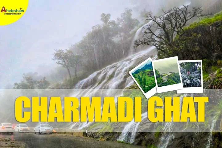
Charmadi Ghat View Point is a scenic part of the Charmadi Ghat road (NH 73) in the Western Ghats of Karnataka. The road joins Kottigehara in Mudigere taluk (Chikmagalur district) with Charmadi village in Belthangady taluk (Dakshina Kannada district). There is no entry fee. From the road, you can see misty mountains, deep valleys, thick forest, and seasonal waterfalls. It is a good stop for road trippers, nature lovers, and one-day travellers. Drive slowly, because the road is narrow and steep, with sharp hairpin bends.
Hello, I’m Ahetesham Sait, a passionate traveller who writes about Chikmagalur and the Western Ghats. In this guide, I have kept the words simple and the facts clear, so you can decide what to see, when to go, and how to stay safe.
Charmadi Ghat Quick Facts
| Detail | Information |
|---|---|
| Place | Charmadi Ghat (NH 73), Western Ghats, Karnataka |
| Districts | Chikmagalur (Mudigere taluk) and Dakshina Kannada (Belthangady taluk) |
| Entry fee | No entry fee |
| Suggested visiting hours | 7:00 AM to 5:00 PM |
| Distance | 66 km from Chikmagalur, 84 km from Mangalore, about 286 to 340 km from Bangalore (depends on route) |
| Hairpin bends | 12 |
| Best season | Monsoon for waterfalls, after the monsoon for clearer views |
| Time needed | Half a day for the drive and stops (my suggestion) |
Charmadi Ghat photos


Where Is Charmadi Ghat?
Charmadi Ghat is in the Western Ghats of Karnataka, India. It starts at Charmadi village in Belthangady taluk and ends near Kottigehara in Mudigere taluk. The nearby towns are Ujire, Belthangady, Kottigehara, and Kalasa. Ujire is a busy junction where the road splits towards Dharmasthala, Kottigehara and Belthangady. So if you start from the coast, you will usually pass Ujire first. Wikipedia Wikipedia
Charmadi Ghat Distance
- 66 km from Chikmagalur
- 84 km from Mangalore
- About 286 km from Bangalore by one route (some routes are closer to 340 km)
- About 37 km from Mudigere
- About 25 km from Belthangady
The ghat is a long road, so distances change depending on which point you measure from. Use these numbers as a guide and check live maps before you leave.
Entry Fee and Timings
There is no entry fee. Charmadi Ghat is a public highway, so there is no gate or ticket counter. I suggest visiting between 7:00 AM and 5:00 PM, when it is daylight.
| Days | Suggested timings |
|---|---|
| Monday to Sunday | 7:00 AM to 5:00 PM |
Daylight matters here. In the rainy season, officials have in the past stopped night traffic on this road. One earlier order allowed only light vehicles between 6 AM and 7 PM after a landslide. deccanherald
About Charmadi Ghat View Point
Charmadi Ghat is a mountain road in the Western Ghats. It begins about 153 metres above sea level at Charmadi village and rises to about 970 metres near Kottigehara. The road has 12 hairpin bends and gets more than 7,000 mm of rain in the monsoon. The Ghat is known for lush forests, streams, waterfalls, curvy misty roads, mountains and valleys. Driving here gives scenic views and a chance to see seasonal waterfalls. On a clear day, you can even see the Mangalore coastline from the top. The roads are narrow and steep in places. Wild animals, including elephants, may be seen, so stay alert and never go near an animal.
Charmadi Ghat Viewpoints: Where to Stop and Enjoy the View
Charmadi Ghat has no single ticketed view point. The views come from many safe spots along the road and from the peaks above it. Here are the main Charmadi Ghat viewpoints to know about.
Views from the Hairpin Bends
The easiest way to enjoy Charmadi Ghat View Point is to drive the hairpin bends slowly and stop only at wide, safe places. The ghat stretch is about 25 km long between Kottigehara and Charmadi village. From many bends, you can see the valley, the forest, and the road below you like a ribbon. In clear weather, the view is long. In the monsoon, clouds and mist cover the hills and sometimes hide the view completely. Never stop on a blind curve.
Travel reports also advise driving in daylight and avoiding quick photo halts on blind curves. Park fully off the road and stay away from traffic. Buses may not stop at every viewpoint, so bus travellers can enjoy the view from their seat.
Jenukallu Gudda
Jenukallu Gudda is a high point named after the many beehives under its overhang. “Gudda” means hill in Kannada and Tulu. Jenukallu is one of the well-known peaks of the Charmadi range. From higher up, travellers have enjoyed a view of the valley with the road curling along the mountainside. Most visitors enjoy this peak as part of the scenery rather than as a separate stop. Trekkers do include it on longer routes. If you plan to trek, go with a local guide or a trek group, carry water and start early.
Balekallu Gudda and Kodekallu Gudda
Balekallu Gudda is near the 11th hairpin bend, and Kodekallu and Jenukallu are also peaks in this range. In Kannada and Tulu, “kode” means umbrella and “kallu” means rock. Kodekallu is named after an umbrella-shaped rock at the top, and from its summit you can see the Kudremukh forest, Durgadabetta and Banjarumale hills. These are trek viewpoints, not roadside stops, so plan time for a hike.
Where the trek starts
Two popular trails start from the Charmadi bus stop and from Bidruthala village. Ask local people or a trek operator about rules and weather before you go.
Ettina Bhuja (Shishila Gudda) Trek
Ettina Bhuja is a short trek in the Charmadi belt. Locals also call it the Shishila Gudda trek, and the top gives wide views of the Charmadi range and Shishila valley. One trek operator lists it as about 4 km for the round trip and says forest permission is needed. If you want a viewpoint that needs more effort than a roadside stop, this is a good option. Check permission rules before you plan it.
Charmadi Ghat Falls You Can See from the Road
Some waterfalls can be seen from the road while you travel through the Ghat. All of them depend on rain, so the amount of water changes a lot with the season. The three falls below are the ones listed for this road. You may also see small seasonal falls and streams along the way. For all of them, use the same rule: watch from a safe place, not from the middle of the road.
Malaya Marutha Falls
Malaya Marutha Falls is one of the falls that you can spot while driving through Charmadi Ghat. Like most falls on this road, it is seasonal. It looks best during and just after the monsoon, when the hill streams are full. In dry months, the flow can be thin. Park your vehicle fully off the road and switch on the parking lights if there is fog. Keep away from wet rocks and slippery edges, and do not try to climb to the top. If you want a photo, take it from a safe spot at the side of the road.
Charmadi Rock Waterfalls
Charmadi Rock Waterfalls is another fall you can see from the road. In heavy rain, falls like this can grow strong very fast, and the road can become wet and slippery near them. So slow down and watch for stopped vehicles ahead of you. Many small falls on ghat roads have no sign board, so use your eyes and ask local people if you are not sure which fall you are looking at. After the rains slow down, the flow becomes calmer, and it is easier to enjoy the view.
Trish Waterfalls
Trish Waterfalls is the third fall listed along the Charmadi Ghat road. Because it is seasonal, it is best to visit when the hills are green and wet, but not in the worst rain. The best way to enjoy it is to plan a slow drive with a few short stops. Carry a rain jacket and keep your phone camera ready. Do not walk down slopes near the road to get closer, because the ground is often loose and slippery in the monsoon. Take your time and enjoy the view from a safe place.
Best Time to Visit Charmadi Ghat
You can visit Charmadi Ghat throughout the year, and the scenery changes with each season. The best time to visit Charmadi Ghat depends on what you want to see. If you want waterfalls and mist, go in the monsoon. If you want an easier and clearer drive, go after the heavy rain. A simple suggestion is September to December, when the hills are still green and the rain is lighter. Whatever month you choose, check the weather before you plan your Charmadi Ghat View Point visit.
Monsoon (June to September)
During the monsoon, seasonal waterfalls come alive and the mountains and valleys are often misty. This is when the Ghat looks most dramatic, but it is also when you need the most care. Rain can make the road slippery. Travel news sites reported landslide closures and restrictions on Charmadi Ghat during the August 2026 rains. Check the weather and road news on the day you travel, and keep a flexible plan.
After the Monsoon and Winter (October to February)
After the heavy rain, the road is usually calmer and the hills stay green. Winter is quite chilly here compared with other places in Dakshina Kannada, because of the height. Falls such as Bandaje are also usually best after the monsoon. For first-time visitors, this is usually the easiest season for a safe drive.
Summer (March to May)
The road is easy to drive, but the waterfalls are seasonal, so expect little water. Karnataka Tourism advises avoiding summer for Bandaje Falls because the forest is dry and hot and the falls carry very little water. Summer is fine if you only want the drive and a quiet stop.
How to Reach Charmadi Ghat
By Road
Kottigehara and Ujire are the nearby towns. The Ghat is around 20 km from Kottigehara.
From Bangalore
Drive towards Chikmagalur, then continue via Mudigere and Kottigehara to enter the ghat. The distance is roughly 286 to 340 km, depending on the route. Use a live map for the best route and time.
From Mangalore
Drive towards Mudigere via Ujire. Charmadi Ghat lies on this route, about 84 km from Mangalore.
From Chikmagalur
Charmadi Ghat is about 66 km from Chikmagalur. Drive via Mudigere and Kottigehara, then go down the ghat.
By Bus
Trek guides say you can take a bus to Dharmasthala and then a local bus to Charmadi. Buses may not stop at every viewpoint, so you will mostly enjoy the views from the bus. trekupindia
By Train
Mangaluru Junction is the nearest railway station, about 77 km away. From there, take a taxi or bus towards Mudigere and Charmadi Ghat.
By Air
Mangaluru International Airport is the nearest airport, about 90 km away. From there, take a taxi or bus towards Mudigere. Shivamogga Airport is about 162 km away.
Plan a Trip to Charmadi Ghat
If you want to plan a trip to Charmadi Ghat, keep it simple: start early, drive slowly and do not try to see everything in one day. Charmadi Ghat View Point works best as the main stop, with one or two nearby places added.
How Much Time Do You Need?
For the road and a few stops, half a day is enough. If you add nearby falls such as Didupe or Kodige, plan a full day. If you want to trek to Bandaje Falls, plan one extra day. This is my suggestion, not a fixed rule.
Suggested One-Day Plan
This is a suggested plan for readers. It is not a record of my own trip.
- Morning: Start early from Chikmagalur or Mudigere and reach Kottigehara.
- Late morning: Drive down the ghat slowly. Stop at safe spots for the viewpoints and roadside falls.
- Afternoon: Reach Ujire for lunch. Choose one nearby place, such as Didupe Falls, if the weather is good.
- Evening: Return before dark. Do not drive the ghat at night.
What to Carry
- Rain jacket or umbrella
- Drinking water and light snacks
- Power bank and an offline map
- A bag for your waste
Tips for Visitors
- The roads are narrow and steep, so drive carefully.
- If you stop to see a view, stay well away from the road and traffic.
- Buses may not stop at every viewpoint. You can enjoy the views from the bus.
- Do not litter. Carry your waste with you or throw it away responsibly.
- Wildlife may be seen. Never go close to animals, and never feed them.
Pros and Cons
| Pros | Cons |
|---|---|
| No entry fee | Narrow, steep road with sharp bends |
| Scenic drive with mist and green hills | Fog and rain can hide the views |
| Seasonal waterfalls on the road | Road may close in heavy rain |
| Many nearby places in one trip | Buses may not stop at viewpoints |
Charmadi Ghat Places to Visit: Nearby Mudigere Tourist Places
After you finish Charmadi Ghat View Point, you can add one or two nearby places. Distances below are from Charmadi Ghat, as listed in the original post. They are approximate, so check live maps. These Charmadi Ghat places to visit fit well in a day or two, and several are also popular Mudigere tourist places.
Ermayi Falls
Ermayi Falls is a scenic three-tier waterfall near Ujire. It is about 17 km from Ujire and 22 km from Charmadi Ghat. One traveller described the main fall as about 30 feet high. It lies in the Western Ghats forest. A 2021 travel blog said the main falls were closed to visitors because the landowner no longer allowed people through the path, and only a small fall nearby could be visited. Access may have changed since then, so ask locally before you drive there. Go after rain, but not in heavy rain. Take care on slippery rocks.
Kajoor Dargah
Kajoor Dargah is in Kajoor village, about 700 metres from Ermayi Falls and 22 km from Charmadi Ghat. It is a religious site surrounded by green landscapes and mountains. The road to Kajoor and Didupe branches off the Ujire road before Mundaje. It makes an easy, calm stop if you are already visiting Ermayi Falls. Please dress modestly, speak softly, remove your footwear where asked, and ask before you take photos. Visit in daylight, because the roads here are quiet and narrow.
Didupe Falls
Didupe Falls is near Ujire. It is about 23 km from Ujire and 28 km from Charmadi Ghat. It is also known as Kadamagundi Falls and is over 70 feet tall. Reaching it may mean a 2 to 3 km trek through forest and across streams. A board at Didupe asks visitors to take permission from the Belthangady Range Forest Officer. A 2021 blog also reported a fee of ₹200 per person. Rules and fees change, so confirm locally. Wear shoes with a good grip and carry water.
Rani Jhari
Rani Jhari is a viewpoint about 44 km from Charmadi Ghat. It is known for green mountains, misty valleys, and cloud-covered views. Some tour listings also call it Rani Jhari Secret Falls. It is a good stop if you like quiet viewpoints and photography. Clear mornings usually give the best views, because fog and rain can hide the valley. Keep some time in your plan, since the drive from Charmadi Ghat takes a while.
Kodige Falls
Kodige Falls, also known as Durgadahalli Falls, is about 42 km from Charmadi Ghat. It is on private property, with food, washrooms, and changing facilities. I have visited Kodige Falls twice, once on a weekday and once on a weekend, after the monsoon. The trek was easy, and the falls looked lovely from the top. But it is a small fall, so weekends felt crowded. If I visit again, I will go on a weekday. Rules and entry fees can change, so ask at the gate.
Kelagur Tea Estate
Kelagur Tea Estate is about 37 km from Charmadi Ghat, in Kelagur village of Mudigere taluk. It is spread over roughly 1,000 to 1,200 acres and is known for rolling hills, green landscapes, and tea production. It is described as one of the oldest tea estates in Karnataka. It uses traditional methods to make organic tea, and it does not get very large crowds. It is a working estate, so please stay on the paths and ask locally about visiting rules.
Bandaje Falls and Ballalarayana Durga Fort Trek
Bandaje Falls (Bandaje Arbi) and the Ballalarayana Durga Fort trek are a popular trekking choice in this region. The falls are about 200 feet high. The fort was built in the 12th century by the Hoysala Empire, and the trek is rated moderate. The original post describes the trek to Bandaje Falls as about 8 km from the Chikmagalur-side route. One trek operator lists about 15 km for the full round trip.
Permission and booking
Karnataka Tourism says you must take forest permission from the Belthangady wildlife range office in Kudremukh National Park. Check current booking rules and trail conditions before going. karnatakatourism
Best time and what to expect
The best time is after the monsoon, and summer should be avoided because the falls carry very little water. There are no permanent places to stay because of the dense forest and permit rules. Carry your own food, and do not carry single-use plastic. karnatakatourism
More Mudigere Tourist Places
Wikipedia lists Bettada Byraweshwara Temple near Mekanagadde, Nanyada Byraweshwara Temple near Byrapura, Devaramane near Gutthi, and Shankara Falls as popular tourist places in the Mudigere area. Horanadu is also in Mudigere taluk. Check each place for current timings before you go. Wikipedia
My Final Thoughts
Charmadi Ghat View Point is a good choice for nature lovers, road trippers, and one-day outings. If you are travelling between Chikmagalur and Mangalore, this route is worth taking. The monsoon gives memorable waterfall views, but check the weather and road conditions, and drive carefully. When you plan a trip to Charmadi Ghat, add only one nearby place, so you do not rush. And if you enjoy Mudigere tourist places, Kodige Falls, Rani Jhari, and Kelagur Tea Estate make a good second day.
FAQs about Charmadi Ghat View Point
Where is Charmadi Ghat?
Charmadi Ghat is in the Western Ghats of Karnataka. It connects Kottigehara in Mudigere taluk (Chikmagalur) with Charmadi village in Belthangady taluk (Dakshina Kannada). If someone asks where is Charmadi Ghat on the map, look along NH 73 between Kottigehara and Ujire.
What is the best time to visit Charmadi Ghat?
You can visit all year. The monsoon (June to September) is best for waterfalls and mist, but the road needs more care. September to December is a good balance of green hills and lighter rain.
Is there an entry fee for Charmadi Ghat View Point?
No. It is a public highway with no ticket counter.
What are the timings for Charmadi Ghat?
There is no gate. I suggest 7:00 AM to 5:00 PM, in daylight.
How far is Charmadi Ghat from Chikmagalur, Mangalore and Bangalore?
About 66 km from Chikmagalur, 84 km from Mangalore, and 286 to 340 km from Bangalore, depending on the route.
How many hairpin bends are there in Charmadi Ghat?
There are 12 hairpin bends.
Which Charmadi Ghat falls can I see from the road?
Malaya Marutha Falls, Charmadi Rock Waterfalls, and Trish Waterfalls can be seen from the road in season. They are strongest during and after the monsoon.
Is Charmadi Ghat safe to drive in the monsoon?
It can be, if you drive slowly, in daylight, and check road news first. Heavy rain, fog, and landslides can close the road, so keep a backup plan.
Which animals can I see at Charmadi Ghat?
The original post mentions elephants, panthers, wild boar and deer. Sightings are not guaranteed. Keep a safe distance.
Which is better, Charmadi Ghat or Shiradi Ghat?
In my opinion, Charmadi is better for scenery. The best road for you depends on where you are going and the current road conditions.
What is the nearest railway station and airport?
Mangaluru Junction (about 77 km) and Mangaluru International Airport (about 90 km). Shivamogga Airport is about 162 km away.
How many days do I need to plan a trip to Charmadi Ghat?
Half a day is enough for the road and viewpoints. Plan a full day if you add nearby falls, and an extra day for the Bandaje trek.
Which Mudigere tourist places are near Charmadi Ghat?
Kodige Falls, Rani Jhari, Kelagur Tea Estate, and Bandaje Falls with Ballalarayana Durga Fort are all within reach.